


 Neither Lisa or I had ever visited Death Valley National Park and December and January are supposedly the best months to visit climate wise, so on Wednesday I took the afternoon off and Lisa picked me up from BART in Oakland to begin our trip to the desert. It’s over 500 miles (800 kilometers) from San Francisco to Death Valley – too much for an afternoon with a 10 month old – and we never miss an opportunity to drop in on the Bakkers, so we stopped in Visalia at the Bakker dairy for the night on Wednesday. Great to see the girls and Brooke and Kevin. Kevin had been cooking baby back ribs for us since noon in his new smoker, absolutely delicious! He let me in on his secret: a spray bottle of apple juice to dowse the ribs every hour or so to keep them moist.
We didn’t realize just how far it is from San Fran to Death Valley until we were part way through the drive from Visalia to Furnace Creek on Thursday. Boy it’s a long way! It’s a great drive though: the winding canyon along the Kern River out of Bakersfield was a beautiful section of road and the Joshua tree-filled high desert near Walker Pass after Isabella Lake was unlike any landscape I’d ever seen. We stopped off in the desert outpost of Ridgecrest for lunch at a sketchy Mexican establishment, fuelled up the truck and continued on through the barren wasteland leading into Death Valley National Park.
 The mountains forming the western side of Death Valley are called the Panamint Range, striking peaks rearing up from below sea level to over 11,000 feet in some spots. Completely devoid of any kind of plant life and a myriad of different colors due to all the different types of rocks and minerals comprising the earth, they were quite a sight as we headed north out of Ridgecrest and through Searles Valley. Searles Valley was an interesting spot, a small mining town where it seemed the only employer was the local mineral company. Amazing the lengths some people will go for a buck! The wasteland west of the Panamint Range is a naval weapons test site, Lisa saw a flash out the corner of her eye as we were cruising highway 190 and a few seconds later the truck was buzzed by what looked to be an F-16 Fighting Falcon banking a turn a few hundred feet above. We cruised passed Panamint Springs and over the Panamint Range to finally find ourselves in the National Park. Did I mentioned that it’s a freakin’ long way from San Francisco?!


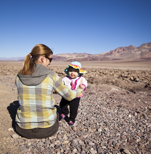
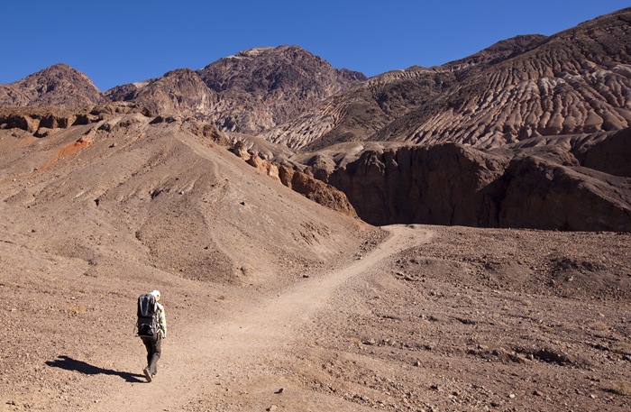
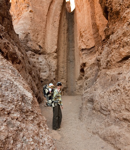
 We spent our stay lodged at Furnace Creek, one of the three settlements inside Death Valley National Park. Death Valley covers a huge area of land, some of the attractions are more than 50 miles apart, so we had to do a bit of planning to make sure we didn’t spend our whole time in the truck. We stopped off at Mosaic Canyon on our way to our cabin in Furnace Creek, Mosaic is one of the many canyons for which the park is famous and is also a popular attraction due to the fact it can be accessed without a high-clearance vehicle. We topped Lilia up with a bottle, strapped her in the pack and headed into the canyon for the couple of mile hike along its length.
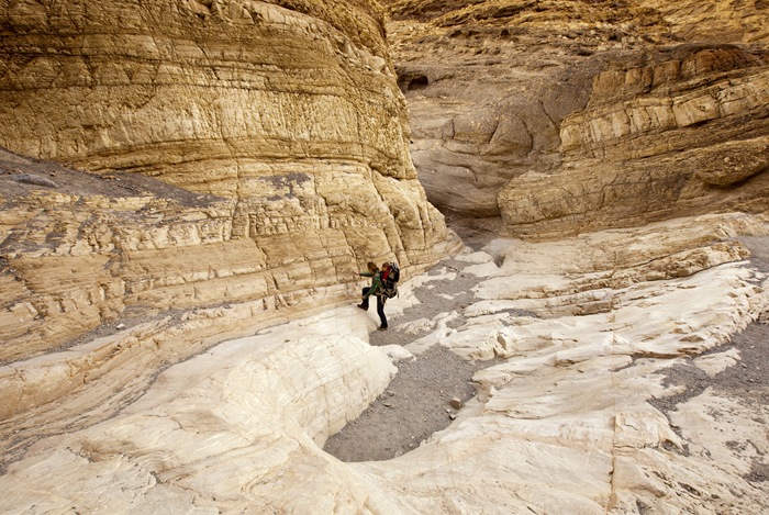
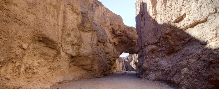
 Mosaic Canyon starts out as a narrow pathway through towering polished marble walls, at some points we were scurrying along the path propping ourselves up by pushing off the canyon walls with our hands. After roughly half a mile the canyon opens up to a width of roughly a few hundred feet, giving us a brilliant view of the
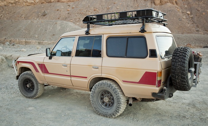
  mountains of the Panamint Range lit by the afternoon sun. I had to snap a shot of the Land Cruiser pictured here to the right, it was parked in the lot at the mouth of Mosaic Canyon. I’ve never seen a diesel FJ60 in the States before, especially one as well kept as this one. Brought back a lot of good memories of Bessie and all our adventures with her…


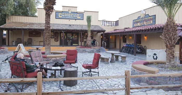
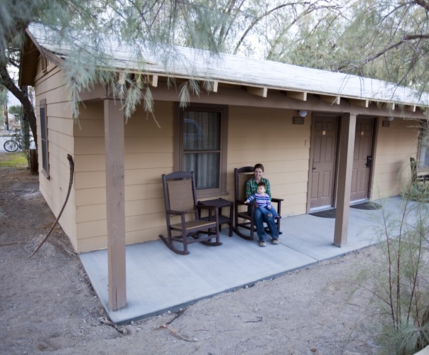
 Furnace Creek is the most central settlement in the national park, it’s home to a few campgrounds, the Furnace Creek Ranch as well as the famous Furnace Creek Inn, an extravagant hotel that rivals the Ahwahnee in Yosemite for remote, national park luxuriousness. The Ranch was more our style, we had a brilliant little cabin for our two nights there. The Furnace Creek village is very well done, boasting a steakhouse, saloon, general store, cafe, golf course and spring-fed swimming pool. We dined at the café one night and saloon the next, food was nothing to write home about but great considering our remote location.


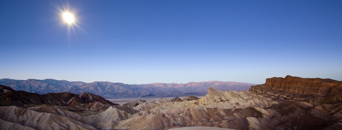
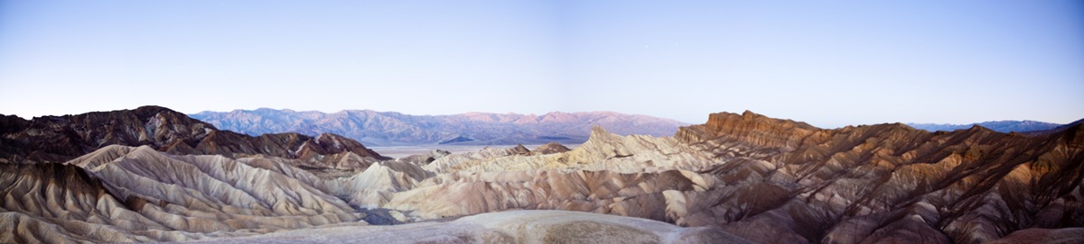
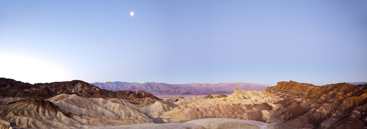
 Lilia woke bright and early at around 5:00AM on our first night in Death Valley. She should know by now that if she does that and Dad’s around she’s going to get taken on an adventure somewhere! So the two of us hopped in the truck and drove up through the Funeral Mountains to Zabriskie Point to watch the sun rise from one of the best vantage points in the park. We arrived when the sun was still well below the horizon, making the short hike from the parking lot to the lookout in the dark with Lilia jabbering away all rugged up in
  the pack on my back. The moon was illuminating the barren landscape enough to snap some (extremely) long exposure shots of Golden Canyon and towering Telescope Peak. What looks like the sun in these photos is actually the moon, so bright just before the sun came over the horizon behind us. The colors of Golden Canyon and the sky above the Panamint Range were brilliant just as the sun was rising, I managed to get one photo of them before Lilia decided she’d had enough of the 34°F (1°C) morning temperatures.


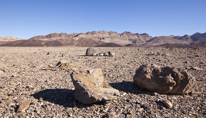
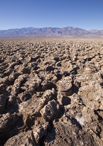
 We spent most of the day on Thursday exploring the region of Death Valley to the south of Furnace Creek: Devil’s Golf Course, Artist’s Drive, Natural Bridge and Badwater Basin. Most of the valley south of
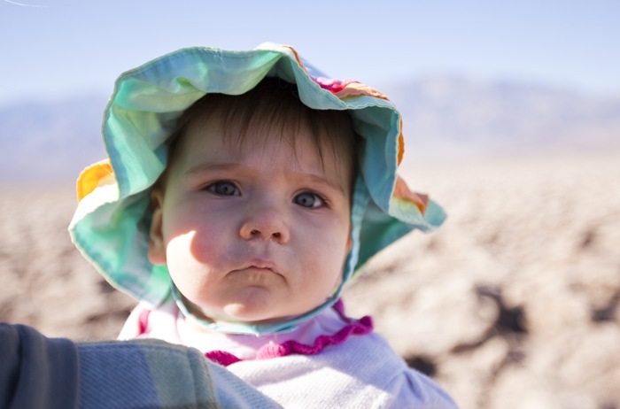
  Furnace Creek is below sea level, resulting in areas of earth with an array of crystalline structures scattered across the surface. The first one we visited was Devil’s Golf Course, an expanse of rock salt eroded by wind and rain into jagged spires. The structures are so sharp and unwelcoming that “only the devil could play golf on such rough links.” It was quite a trip walking through the salt mounds, they would crackle under foot with each step and the sharpness of some of the crystals was definitely not understated! See if you can find Lisa and Lilia camouflaged in one of the photos below.


 Next stop was Natural Bridge Canyon, another of the many canyons formed by torrents of floodwater captured by the bordering mountain ranges. Natural Bridge Canyon really gave us an idea of the sheer amount of water that must gush into the valley through the canyons during flash floods. The walls of the canyon were lined with dry waterfalls carved by floodwaters and the natural bridge itself was an immense structure, made us feel like ants underneath it.


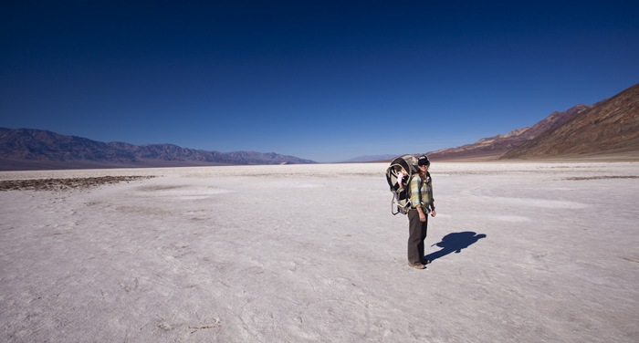
 Badwater Basin is the lowest point in Death Valley and is also the lowest point in North America: 282 feet (86 meters) below sea level! The basin is the location of a small spring which is quickly turned saline by the surrounding salt pans. The salt stretches almost to the horizon each way along the valley. Even though it was only 65°F (18°C) at the most during the middle of the day when we were at Badwater, the sun’s reflection off the surrounding salt made it feel at least 20°F hotter. We could feel the rays reflecting off the salt and attacking our cheeks underneath the brims of our hats. Death Valley is the location of the hottest temperature ever recorded in the United States – 134°F (57°C) on July 10, 1913 – we could imagine what it must be like when the average daytime temperature during the middle of summer is 115°F (46°C). Can you believe that Death Valley is the site of the Badwater Ultramarathon in July?! Such a striking dichotomy of environments: the brutally hot Badwater Basin in the foreground at 282 feet below sea level with Telescope Peak capped in snow towering over 11,000 feet in the distance.


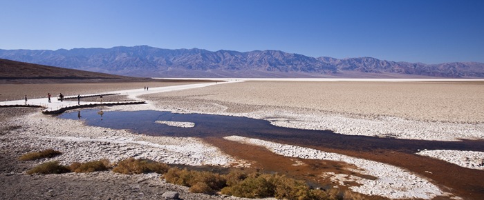
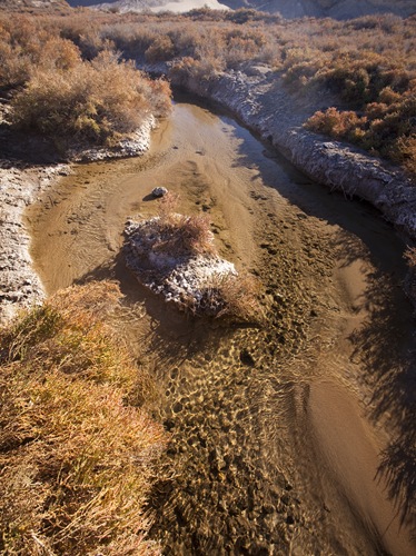
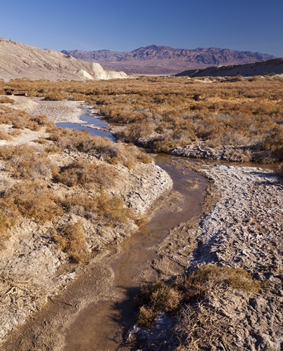
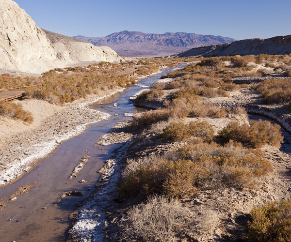
 Our last stop and, we both agreed, probably the most beautiful of the locations around Furnace Creek, was Salt Creek. In the last ice age Death Valley was covered by a huge freshwater lake home to an array of fish species. Today there are a few freshwater springs bubbling through the dry earth, one of which is Salt Creek located roughly halfway between Furnace Creek and Stovepipe Wells. The headwaters of Salt Creek gush from below the surface as freshwater and within the half mile length of the creek turn more saline than the ocean due to evaporation and the minerals embedded in the soil. The creek is home to a rare and endangered fish called the Salt Creek Pupfish, amazing that a species of fish can thrive in such a harsh environment with what appears to be so little available nourishment.


 There were a couple of spots we left for a future visit to Death Valley: The Racetrack and Scotty’s Castle. The former is a claypan in the remote northern reaches of the park that can be accessed only via 20 miles (32 kilometers) on a high-clearance dirt road, more than 75 miles (124 kilometers) from our lodging at Furnace Creek. The latter – Scotty’s Castle – we actually did get to see on our way out of the national park but Lilia was taking her morning nap at the time and if we’ve learned anything in the past nine months it’s not to wake Tinkerbelle when she’s sleeping!
What an astonishing landscape.
Glad you popped in, it was great to catch up. Neat moon pic.
I like the jeans and moccasins. Looked like a great trip. M
Great pictures! Loved reliving our trips through your pictures and descriptions. It is a beautiful place, in it’s own way. Glad you enjoyed yourself. We will look forward to seeing you again soon when you come our way.
What an amazing place….nature at its best.